How to Choose the Right Geofencing Solution
Geofencing is a versatile technology. It involves location data, user privacy, integrations, analytics and so much more. When it comes to choosing the right geofencing software, the challenge is understanding the advantages and disadvantages of each option.
Every geofencing solution is built differently. For example, some need hardware beacons to work while others don’t. Some only offer circular geofences rather than custom polygons. Some process data on a user’s device, while others process data in the cloud.
These may seem like small details, but each can have a significant impact on your project’s success. It’s important to understand which geofencing provider is the best fit to achieve your business goals. This checklist will help. It covers the essential features to look for in a geofencing provider. We’ll also discuss some non-essential (but nice-to-have) features.
At the end of the article, we’re sharing a free geofencing RFP template you can use to make sure you’re choosing the best vendor for your needs.
Contents:
- Accuracy
- Battery Usage
- Privacy
- Technical Capabilities and Features
- Ease of Use
- Integrations
- Support and Documentation
- RFP Template (free to use)
Obviously, geolocation starts and ends with location accuracy. Consider a restaurant using location tech for drive-thru or curbside pick-up, for example. Without a highly accurate solution, the restaurant would have trouble distinguishing between a car entering the parking lot vs the drive-thru.
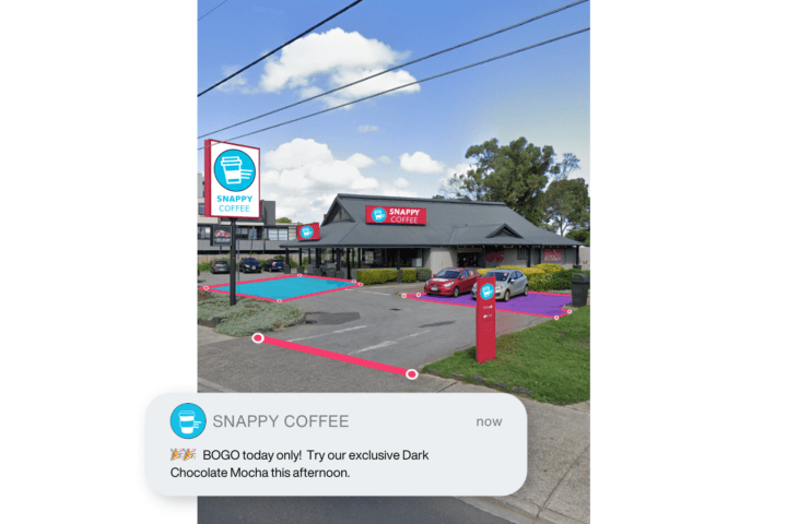
What does that mean for the user experience? Well, the restaurant might send welcome messages when customers are driving on a nearby road — changing the arrival experience from personalized to embarrassing.
Most geofencing tools promise impressive accuracy statistics and say that won’t happen with their tech. Be careful to read the fine print before choosing a provider: sometimes those claims are only accurate when using beacons.
Here are the must-have accuracy features to look for:
☑ Quick confirmations (milliseconds) on entering a geofenced area, enabling realtime use-cases like displaying a personalized menu board in a drive-thru.
☑Average detection of users within 2.5 meters of geofence.
☑ No hardware (e.g. cameras or beacons) required.
Nice to have:
☑ Geofence size as small as 5-10 meters while maintaining 97%+ reliability in detecting that a user has crossed a geofence.
☑ Speed and direction (bearing).
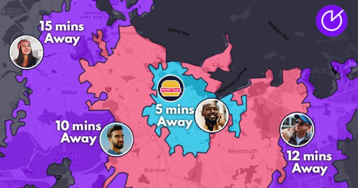
Some use-cases, such as tolling, require a precise understanding of speed and direction. It’s also important for any restaurants or coffee shop that wants to know customer ETA so they can make sure meals and beverages are ready on arrival.

For your business, direction and speed may or may not be relevant. When you access your free RFP template below, you’ll be able to hide or delete any rows that don’t apply.
Using geolocation on a smartphone comes with a tradeoff: the more accurate the signal, the more it drains the battery. If the phone has to keep sending and receiving updated location data, that impacts battery life.
Nobody wants to use an app that quickly drains their battery.
Some geofencing solutions try to save battery life by reducing the signal frequency. Doing that slows battery drain, but it makes the data much less accurate. Dwell time and ETA data become unreliable because so much can happen between signals.
For example, if it takes 90 seconds to refresh the user’s location, someone might drive past your store and be half a block away before the app sends them a custom notification.
Ask your geofencing provider about the tradeoff between reliability and accuracy of detection vs battery drain. Here are some benchmarks to ask about:
☑ SDK consumes minimal amount of device battery per hour.
☑ Data gets processed on the device itself, rather than on a server. This reduces battery drain and increases accuracy.
☑ Can sample location at varying rates per hour, depending on configuration.
Some geofencing providers get location signal updates every 1-2 minutes by default, which makes it hard to know with certainty they a user is on premise.
We developed Bluedot’s geolocation tech so the SDK processes almost everything on the device itself. This makes the software more responsive and accurate. It also provides a faster refresh rate while limiting battery usage.

Most geofencing tools have to push data to servers first, where it’s processed and then sent back to the device. That limits accuracy, slows down features, and makes apps more battery-intensive.
Many people are uncomfortable with their location being tracked. It’s critical to reassure them about the protections the business and provider have in place. At minimum, make sure your solution provider covers the basics:
☑ No collection of personally identifiable information (PII).
☑ Data anonymization.
☑ GDPR and CCPA compliance.
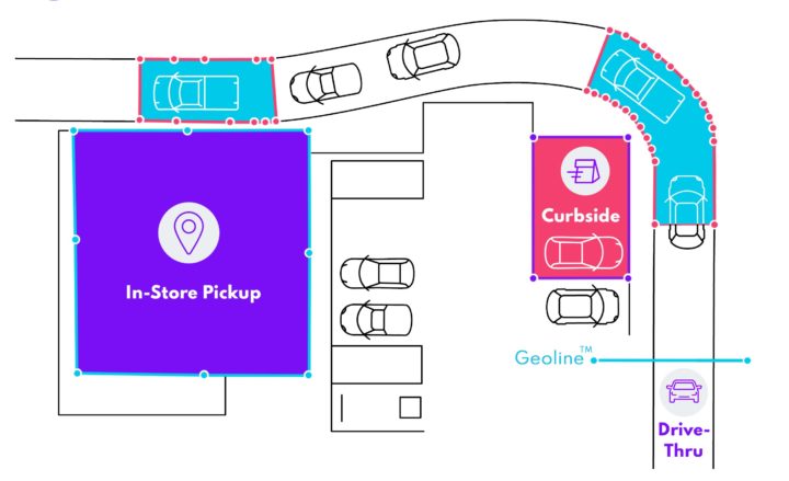
Consider everything you’re looking for from a geofencing solution: Can it handle multiple, overlapping locations? How about multiple geofenced zones within a single location (such as a drive-thru, parking lot and store interior)?

Are there pre-established points of interest (POI) that enable quick set up? Your location provider should be able to offer these features:
☑ Geofences that can be created in the form of complex polygons, not just circles.
☑ Geofences that can overlap regardless of size and shape.
☑ Ability to capture dwell time.
☑ Stays current with the latest iOS and Android updates and supports cross-platform wrappers or tools (e.g. React Native, Maui, Flutter).
☑ Ability to differentiate at the sub-property level (e.g. curbside, parking lot, in-store or drive-thru).
☑ Geoline™ technology — razor-thin virtual wires that can trigger entry and exit signals with precision (especially useful for drive-thrus).
Nice to have:
☑ ETA tracking capabilities.
☑ Analytics and a live dashboard.
Your ability to scale with your geofencing provider might depend on which of these features they offer.
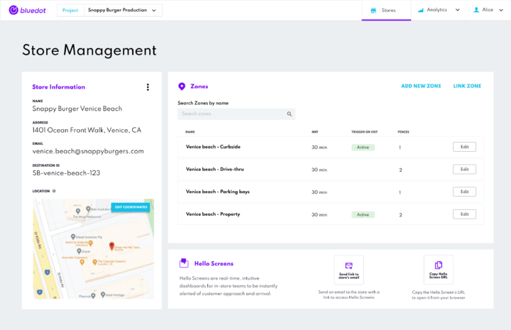
Not all geofencing platforms are built with simplicity in mind, and that can make implementation a slow process. Imagine inputting each store’s coordinates, drawing geofences around the locations, entering names, and linking each location to your store management platform. That would be exhausting. Your geofencing solution should allow quick setup.
Once you’ve gone live, it should require minimal hands-on support when you need to make changes.

Look for these features:
☑ Platform support for Android and iOS phones and tablets
☑ Less than a week required to implement SDK, on average.
☑ Minimal maintenance.
☑ Ability to mass-import existing zones or locations (POI).
☑ Data export via API or CSV.
Automated features can help reduce the time to implement or modify the software, whether you’re setting up stores via POI, or drawing geofences on a simple Google Maps overlay.
Typically, geofencing is a piece of a larger puzzle — like frictionless drive-thru or a better loyalty experience. That’s why it’s crucial to choose a location software that integrates with a variety of solutions including Braze, Airship, Olo, Segment, Salesforce Marketing Cloud, Oracle Responsys, mParticle and others.
These are some of the most important integrations to look for:
☑ Order management providers.
☑ Messaging providers.
☑ Customer Data Platforms (CDPs).
Keep in mind that a good geofencing company will work with you on the integrations that matter most to your business.
Make sure your geofencing provider helps with implementation, documentation, and customer support:
☑ Online ticketing
☑ Robust documentation
☑ Dedicated success manager
The service license agreement (SLA) should include details about how responsive the provider will be to any critical issues that may come up.
Based on our experience and what we hear from our clients, these details are the most important — but this checklist is just a starting point.
Fill out the form below for a fully editable RFP template that expands on this checklist. It’s free to use. Make a copy, remove anything unnecessary, add anything you need, and get the geofencing software you deserve!